Understanding the New Deadly Disease Outbreak Map for Vulnerable Regions
Sunday, 26 April 2026, 10:46
Overview of New Disease Outbreak Mapping
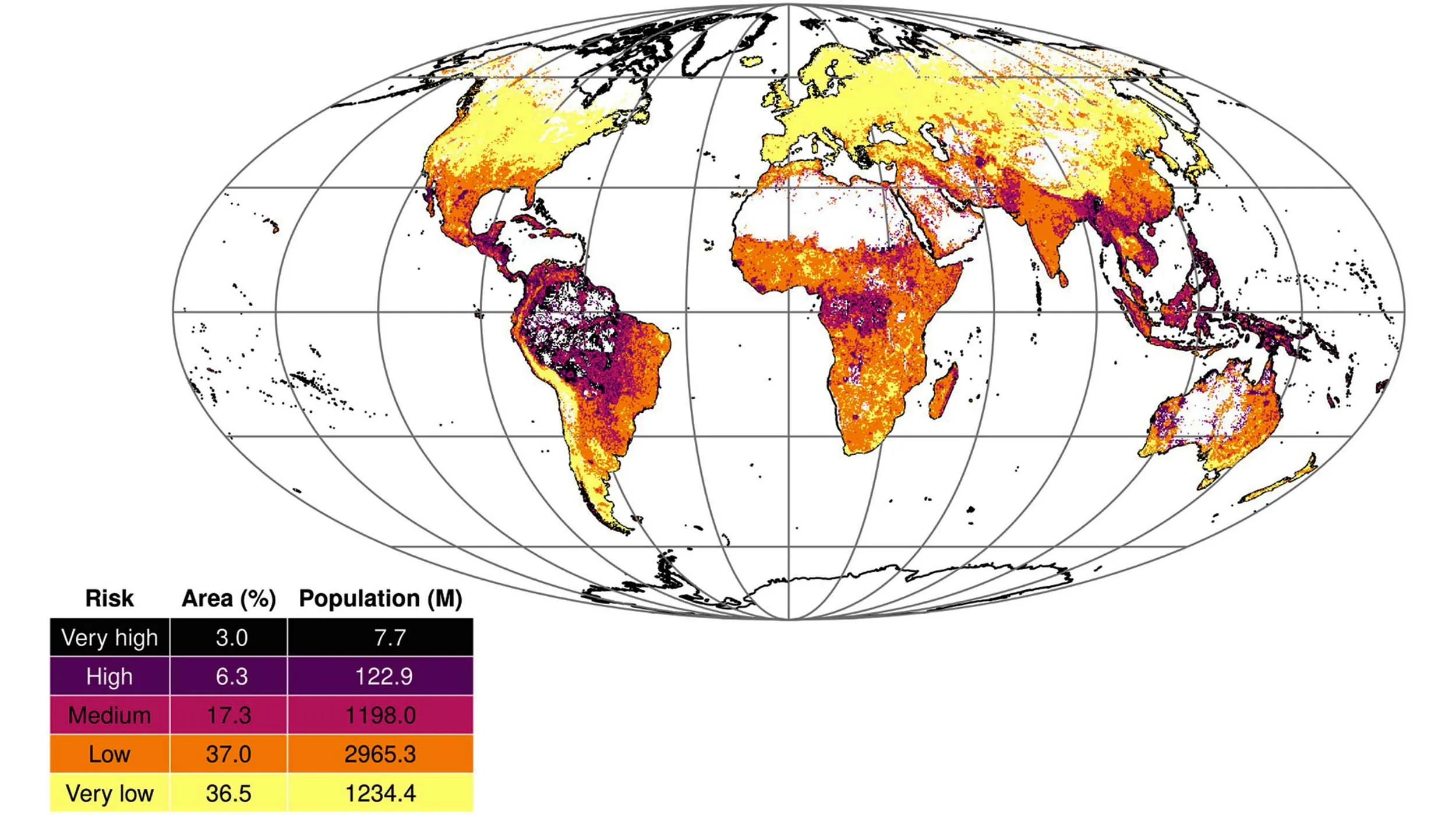
The new deadly disease outbreak map developed through global modeling indicates that around 9.3% of the world's land areas face a heightened risk for dangerous disease outbreaks. This alarming statistic underscores the urgency for health authorities to reassess strategies surrounding disease prevention.
Implications for Public Health
- Risk Assessment: Identifying regions with high vulnerability is critical for targeting public health interventions.
- Global Monitoring: Continuous mapping allows for monitoring of emerging threats.
- Preparedness Planning: Regions flagged as high risk can prepare better for potential outbreaks.
Moving Forward
Public health officials must prioritize resources in noted regions, employing a strategic, data-driven approach to reduce vulnerability to future disease outbreaks.
This article was prepared using information from open sources in accordance with the principles of Ethical Policy. The editorial team is not responsible for absolute accuracy, as it relies on data from the sources referenced.